Great Motorcycling Roads, Peak Perfect
John Newman has explored another great motorcycling road - here is the the story - enjoy!
John Newman
The long and winding road
Nowhere in the UK is that far in terms of motorcycle travel; and living and riding on a relatively small piece of land is probably why we often seek to expand our horizons by pushing out across mainland Europe and beyond. But on our compact island, the landscape, networked by trunk roads and myriad minor roads and tracks, is unique in its diversity and accessibility. Here is another chapter in our Great Motorcycling Roads series to tempt you out for some great riding and fantastic scenery.
Hills of the North rejoice
My geographical fortune as a motorcyclist is to live within a short riding distance of some of the UK's most enjoyable and inspiring areas: midway between the Yorkshire Dales and the Peak District; with the Lakes and the North Yorks Moors National Park requiring just a little more travelling time.
The Peaks National Park area has seen its share of controversy down the years as far as (high speed) motorcycle riding is concerned. Focused on popular stretches of road like the Cat and Fiddle run, the A537 from Buxton to Macclesfield - now with a fifty mph limit and festooned with average speed cameras - and the A6 from Buxton to Bakewell. At one period, such was the concern about high speed, that the police used a helicopter to monitor bikes on this stretch, and there was talk of a bike ban within the national park boundaries.
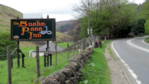
Plenty of room at this Inn
A snakey array of bends, cambers, straights and kinks
Another favoured Peaks route is a stretch of the A57 named 'Snake Pass', a challenging section of well surfaced Tarmac running out of the small town of Glossop through to the outskirts of Sheffield: via the Upper Derwent Valley, graced by the Ladybower reservoir which covers 6,500 acres of the valley floor. This piece of road carries a rider over moorland, through forest areas, and offers up such an array of bends, cambers, straights and kinks that it encourage riders to come back time and again to test their machine handling skill and concentration.
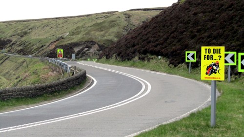
Just around the bend
In common with many roads of this type, a fifty mph speed limit applies; and dotted along the way amongst the large bright bend direction arrows are the familiar 'To die for' warning posters. But there are no permanent speed measuring cameras, and it's not an environment in which mobile radars can be easily parked up.
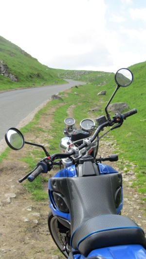
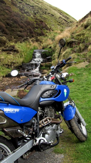
Taking my Mastiff for a run
On a cool blustery day in a spring period where we are all waiting for a turn in the weather to encourage us to remove the warm inners from jackets and pull on unlined gloves for a change, I decided to give my MZ Mastiff 660 a run out. A super motard style bike with off road pretensions if the right tyres are fitted, courtesy of the XT Yamaha engine they wisely shoved into the frame. It also has the ugliest front end of any other motorcycle I've owned. But handling and stopping power are exemplary, and a fun Snake Pass ride began when I pushed it through the fast uphill bends away from Glossop. It was tempting to dangle a leg...I didn't.
Just walkin' the dog
The first part of the road runs up to 550 metres over open moorland. With higher rugged hills around Kinder Scout away to the south, famous for the 1932 trespass of walkers from Manchester defying land owners and gamekeepers in their demands for access to open countryside.
The road then takes on the character of its name dropping down through a series of tight bends with good sight lines, but demanding respect whatever you're riding. Then it's on through the lower forest sections, past the Snake Pass Inn and on through faster stretches until the outer finger of Ladybower comes into view. Sheep wandering, the occasional logging truck, and cars exiting the pub should be taken into account: it's worth visualising those aforementioned posters now and again.
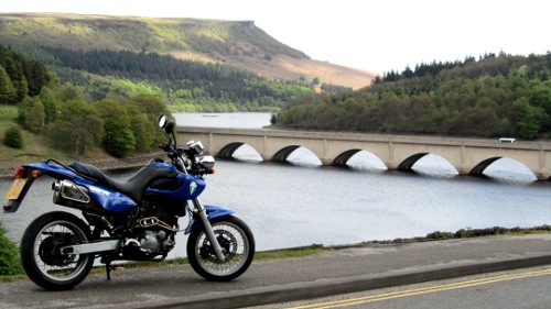
Bridge over not particularly troubled water
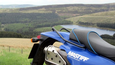
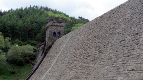
The road runs alongside the water with a steep sided logged conifer forest, dark, and looming over the far bank. It then reaches a wide bridge crossing the reservoir. Here you can divert left onto a no through road running along another spur of the reservoir for a few miles to reach the Fairholme car park and national park facilities (cafe, toilets, information). A frequent stop off for bikes and their riders and a good area for a stretch to view the colossal stone structure of the Derwent Dam, recently the scene of a commemoration fly over of a Lancaster bomber used in the revered Dam Busters raid.
la la la la lalalala la la la la lalalala la la la la laaaa lala....etc
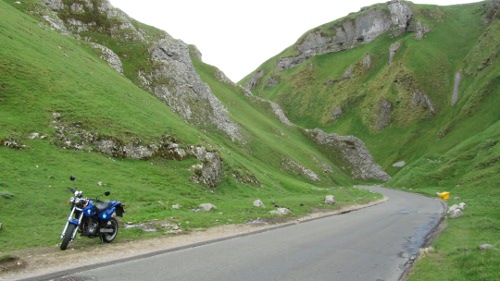
The A57 continues east from Ladybower, and it's not long before the outskirts of Sheffield are sighted. There are some bendy treats on this stretch too but I turned right following the lake shore through the village of Bamford (A6013) and then joined the A6187 towards the villages of Hope and Castleton where the main road ends and dissolves into a white road through a short steep gorge that takes you away from the Hope Valley towards Chapel en le Frith and a network of small roads in the southern section of the national park area that will keep a rider amused for miles.
Gorgeous
Castleton is well known for its four caverns. Dug out for lead and other minerals by the Celts and then the Romans who kicked them out and kept digging. They are now a tourist attraction, with the Speedwell cavern being accessed by boat, along with the souvenir shops, tea shops, pubs and the landscape; with the hill of Mam Tor a strenuous but popular work out for the limbs, and offering up spectacular panoramas from the top
Mastiff about to run the falls?
Follow the road signs to Chapel en le Frith and look out for the sharp right turn to Edale. This narrow road makes a circle back to the main road at Hope, but be prepared for a sharp intake of breath as a vast bowl of Peak hills and vale opens up and the road twists around Mam Tor and drops down to Edale, the start, or finish, of the Pennine Way long distance footpath.
If you do follow the road back to Hope you can reprise the Snake Pass to Glossop and try and get the entry, exit, speed and braking on those bends just right. You know, the ones where you didn't place the bike precisely where you wanted to coming the other way.
John Newman

 EN
EN TH
TH UK
UK