Great Biking Roads...North Circular
John Newman has been out and about on great motorcycling roads again - here's his latest recommendation
John Newman
Helmsley is a prosperous looking market town that sits on the edge of the North York Moors National Park. It's sturdy and attractive buff stone houses and other buildings are redolent of English history and tradition, and it's ideally located to capture a good slice of Yorkshire's tourist trade.
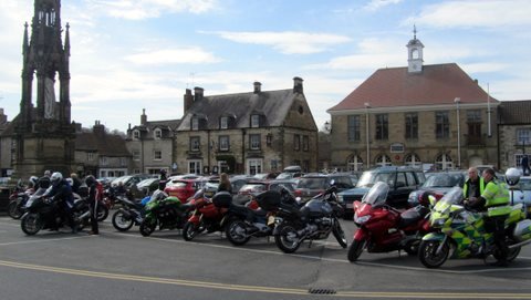
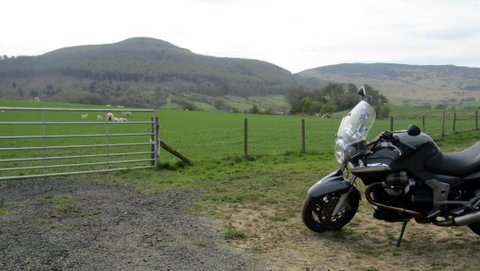
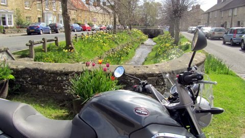
Parked up in Helmsley
Until recently it was a gathering place for crowds of motorcyclists, especially at weekends where they parked up in the market square and frequented the cafes and pubs, taking a break from riding a network of enticing roads across the moors and along the coast. But the local authority curbed the numbers by restricting the bike parking area and making a charge. The cars that now 'clog' the space are of course not nearly as interesting or colourful, but no doubt they make a better contribution to the council's exchequer.
I fetched up in Helmsley on a glorious spring day, and as I stepped off the bike another rider preparing to leave with his pillion passed on his parking ticket with time remaining; and why not - thanks mate.
Full leathers de rigeur
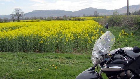
The B1257 out of Helmsley to Stokesley on the northern edge of the moors is ten miles of skill challenging road, or a cruise through some pleasurable pastoral and moorland scenery, depending on your riding taste and mood.
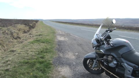
The moors
It runs through Bilsdale, and you can probably spot more Ducatis, R6's, R1's and Fireblades etc along here - pushing their engines, tyres and brakes as the designers intended - than most other places outside of a race meeting car park...full leathers de rigeur.
This road is the first big link in a road chain that literally circles the national park area. A ride of around seventy miles, taking in grand chunks of bleak but captivating moorland scenery and skirting the coast.
From nadgery roads to beautiful places
There are plenty of potential diversions too. Into the heart of the national park area along nadgery roads to beautiful places like Rosedale. Or to Staithes, a precipitous little harbour town wedged between the east coast cliffs. Or Whitby, a visitors magnet with its austere clifftop abbey and old town, and more fish and chip shops than cholesterol medication can deal with.
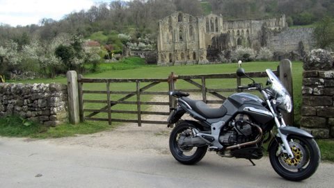
Rievaulx Abbey ruins
I was only a mile along the route when I was tempted to divert at a signpost for Rievaulx Abbey, and dropped down a narrow wooded road into the valley that houses the abbey ruins and hamlet. It was founded in 1152 by Cistercian Monks as their first 'colony' in the north of England, but destroyed in 1538 as Henry the Eighth and his henchpeople rampaged through the country sacking the wealth these places had built up.
Progress of course
The surrounding lands were eventually passed to the Duncombe family who built an aristocratic pile nearby; Duncombe Park. I mention this because the Motorcycle Action Group (MAG) hold their Farmyard Rally there each June. A sign, if any were needed, that the historical wheel has turned from control by the landed gentry to hundreds of motorcycle 'oiks' taking over the grounds. Progress of course.
The road through Bilsdale
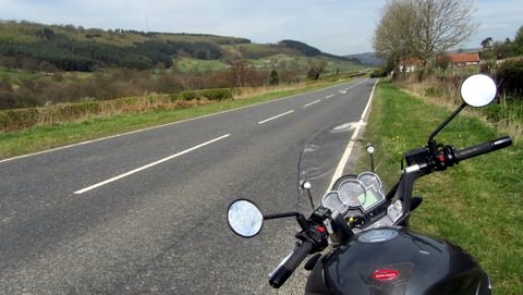
The road climbs out of Helmsley past the national park boundary gates, and then after a few miles drops into Bilsdale through a series of tempting but well sighted bends and woodland, until the floor of the valley opens to a wide vista and stretches where you will want to give the engine a good squirt through straights and swerves before speed restrictions through the village of Chop Gate.
The Cleveland Hills
There's a route alternative here on a minor (white) road to Carlton in Cleveland. It winds up to one of the highest points on the moors – almost 400 metres - before dropping dramatically off the end of the hills onto the flat plain stretching north towards Teeside. From here you can turn east and pick up this 'north circular' again at Stokesley.
Tempting woodland bends
I stayed on the B 1257 through more tempting woodland bends and on to Stokesley and the A173, where a sign post told me that Whitby was 28 miles. Then Great Ayton, a small town with an inviting riverside, links to Captain Cook, and the conical mini volcano like hill called Rosemary Topping; a ramblers and hill walkers target.
Around the bend
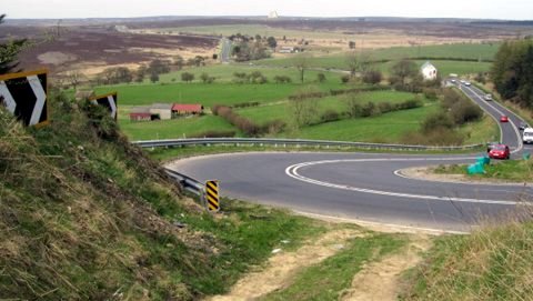
Two roads skirt the north boundary of the moors the A171 and A174 nearer to the coast. I chose the 171, a 'bog standard' main road for a stint. Then, just outside Guisborough it rises sharply through two big sweeping cambered bends that are cautioned at 25mph. Not true of course, but they caught me by surprise and I was tempted to turn back and give them another go in a more appropriate gear. But the grandeur of the moors stretching ahead, and open Tarmac on towards Whitby kept me focused.
The Whistle Stop cafe
Bikes have allotted space at the station car park in Whitby, where the N Yorks Moors steam railway begins and ends. The Whistle Stop cafe here is popular with us lot. But I needed a stretch and walked around the harbour to the fish and chip area, and broke one of my biking rules...don't over fill the digestive system it can make you a sluggish rider. Yes I know it's almost compulsory to order fry ups, pies, chips etc when out on a run, especially with mates; but it does slow up the metabolism and concentration (Whitby fish and chips are consistently enjoyable; I relished every forkful).
Look out for the sheep
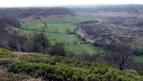
The twenty plus mile stretch south across the national park on the A169 to Pickering was the next section of this ride - again an alternative, and a slightly longer but fast, twisty and undulating route for riders is to continue on the A171 towards Scarborough and then head west along the southern national park boundary. The views from the 169 sweep the eye across the dark heather covered hills under big sky. Bends, dips and fast stretches await, but look out for the sheep.
The Hole of Horcum
...North Piddle and Twatt
Just over half way between the two towns the road drops into a valley and up the other side through a couple of bends and a hair pin that it's hard not to 'attack', providing other (slower) vehicles are not in front. At the top there's a parking area on the left, across the road from a great bowl of landscape called 'The Hole of Horcum'; well worth a stop. On a more vulgar level it ranks in the 'Rude Britain' names list beloved of double entendre humourists, standing alongside Pratts Bottom, Ugley, North Piddle and Twatt (Shetland).
The final twelve miles from Pickering back to Helmsley is a relaxed jaunt along some fast open stretches, but if the run is not long enough for your outing. Have a cuppa in Helmsley and do it again the other way round.
John Newman
for Wemoto News
Have you been on this route or can you recommend any other great rides?
Email us at
[email protected]

 EN
EN TH
TH UK
UK