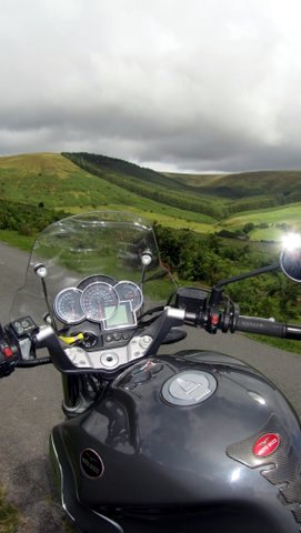
Great motorcyclling roads...
Border Run
John Newman
John Newman has been on a little sojourn in Welsh Wales, out riding on more great motorcycling roads. Here is his report - definitely another ride to whet your appetite.
The river Wye at Chepstow
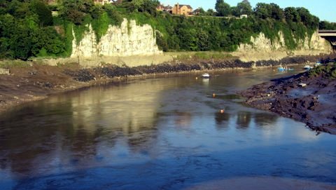
I've by-passed the Welsh town of Chepstow so many times down the years, but have never ventured into the city limits so to speak. Cheptow is an inviting small town on the river Wye, which forms part of the border between our two countries. The well preserved castle guards a bend in the river which is also the location of couple of attractive pubs and wine bars. It's at the beginning of the A466 too, a wonderful stretch of Tarmac which runs for about eighteen miles through the Wye Valley to Monmouth.
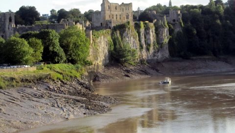
Chepstow castle guards the bend in the river
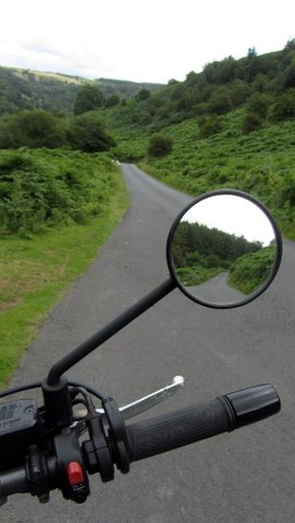
Wales holds a host of motorcycle delights, including the wide swervery of the A40 where a lot of riders head for the gathering points at the Abergavenny bus station cafe kiosk, and the West End Cafe further west in Llandovery; which sits at the heart of some great routes into mid Wales. This run, tracking roads as close to the border as possible, is as eclectic as riding gets
Quiet flows the Wye
How green was my valley
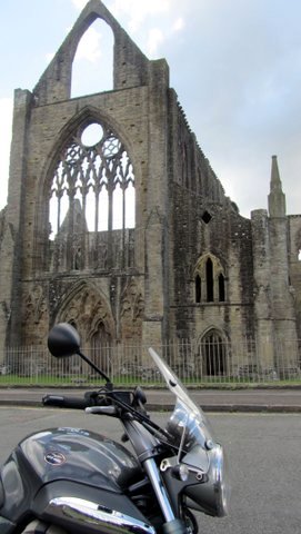
The Skeletal Tintern Abbey
-
-
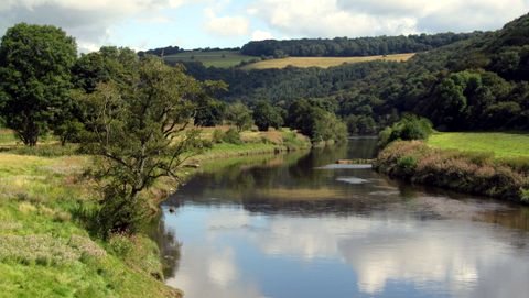
The 466 is very popular with sports bike riders: a good surface and over the first few miles it drops down to the valley floor through a snake of bends. Picking up the Wye again at Tintern, the tall grey skeletal remains of the famous Abbey contrast with the multi greens of the surrounding steep wooded hills. The road follows the river all the way to Monmouth, and there's always something magnetic about running alongside water. On a sunny day you'll hit dramatic contrasts of light and shade as the trees close in over the road.
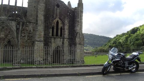
Tintern Abbey
From Monmouth it's B road time. I picked up the B4233 heading to Abergavenny, one of those rural roads that carries little traffic, but being boundaried by farms, some caution is wise even though the temptation is to enjoy attacking the numerous bends, dips and rises with enthusiasm whatever you might be riding. In the near distance almost beckoning you on is the dark shape of Sugar Loaf, one of the highest hills in the Black Mountains.
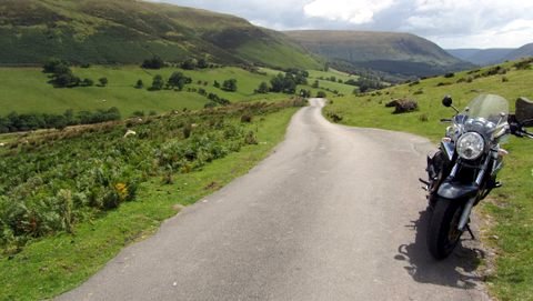
The Black Mountains
Offa's Dyke
The road through the Black Mountains
From Abergavenny head north for a few miles on the A465, towards Hereford until a signpost on the left for Llanvihangel Crucorney catches your attention. Turn here and an unclassified road winds through the Black Mountains following the river Honddu and towards Llanthony Priory
Founded in the 1100's the Priory is a well visited monument and pile of stones that is loomed over by the tall hills that form part of Offa's Dyke; the hills and earthworks that were said to have been constructed as a defensive barrier and boundary by Offa the King of Mercia between his lands and Powys. The Dyke now forms a long distance footpath (176 miles) from the Severn Estuary to Prestatyn on the north Wales coast.
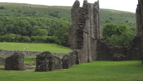
Llanthony Priory and Offa's Dyke
But perhaps more importantly if you're travelling this way, the Priory hosts a bar and hotel in the more preserved and later built parts of the complex. It's a great point to stop off and step off the bike to appreciate the wide sweep of landscape.
Over the hills and far away
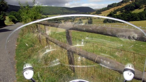
From here the road becomes single track and continues to rise and rise until it reaches the end of the Black Mountains at a spot called Hay Bluff. It's 680 metres high and commands in my opinion one of the finest views in England. On a clear day of course. But to reach this point you may at times be sharing the narrow road/track with cyclists, horse riders, walkers and others, mostly in cars, who want to experience the wild beauty of the surroundings. Oh, and while I remember, there's nearly always a lot of slippy detritus that gets washed off the banks and tracks – it does rain here.
Stop or slow right down as you ride across the Bluff and take in the view. Remember to watch out for the sheep here, this is open grazing land. What goes up always comes down and the road descends, twisting through resplendent woodland in full summer livery, towards the town of Hay on Wye.
Make Hay while the sun shines
Hay is another good stopping place. Free parking for us in the large town car park, and lots of eating and drinking emporia to choose from. If books are your interest or passion, and you have room to carry them; browse awhile in the numerous book shops including the Hay Cinema, which boasts the worlds largest outdoor bookshop set in landscaped gardens. And every year the town hosts the 'famous' Hay Festival of words and literature, which next year takes place in May
www.hayfestival.com
Head across the Wye to the village of Clyro and follow an unclassified road to Painscastle where the B4594 is picked up and followed to the junction with the A44; another great stretch of Welsh roadway that begins in Leominster and eventually dumps you in Aberystwyth after delivering some exciting riding possibilities. But my f
ollow- the- border route made a right turn on the B4357 to Knighton; the town on the Dyke.
A town of two halves
If history is your thing then the Offa's Dyke Centre in the town centre provides info and interactive exhibits about the Dyke and the turbulent history of these lands. Knighton is unique, a border town in that is 'split' between two countries the Welsh county of Powys and English Shropshire.
So far the roads have hugged the border, but from Knighton there's no choice but to deviate slightly. The ride is turning into a B road extravaganza: I headed out of town on the B4355 after sheltering from a monsoon like shower, towards the relatively bustling metropolis of Newtown. But it's rewarding riding through green, green hills and valleys, and the road by passes the thirteen span Knucklas Viaduct - the ever helpful Wikipedia tells me that Knucklas means 'green hillock' in Welsh. Says it all really.
Lonesome train
.JPG)
The end of the line
I rode north west from Newtown on the main road towards Welshpool, heading towards the border again, but on the way I was seduced by another B road that on the map showed several of those black arrow marks indicating steeper hills and sections. It would take me to a village called Llanfair Caereinion, one end of a small steam railway running towards Welshpool.
The map reading and hunch paid off. Lots of bends hills for my V-twin engine to gobble up. It wasn't fast riding, but the concentration required in navigating these smaller roads enclosed by hedgerows, high banks and trees brings its own riding rewards...and aching shoulders if you're on a lump like a Moto Guzzi Breva.
No action at the rail station so I pushed the bike along the main road (A458) to Welshpool and gave the engine some high speed breathing time. Slowing on the outskirts of the town the immaculately polished little steam train was disgorging passengers and filling with water for its return journey. I could have continued following the border north, but from here it hits the towns of Oswestry, Wrexham and then the urban conglomerations around Chester. No thanks. I treated myself to a fast main road run back to Chepstow, and as the sun journeyed further west I could feel the cooling air attacking my unlined gloves. Surely not time to consider autumnal riding gear?
John Newman for Wemoto News
Anyone been in this neck of the woods? Did you enjoy the riding if so?
Let us know at:
[email protected]
.JPG)

 EN
EN